The total land area of Finland is 78 % forest cover. About 61 % percent of this forest area is privately owned. So it’s hardly surprising that just under 13 % of the Finnish population owns an average of 30.3 hectares of forest. Now, the average age of a forest-land owner is 60. Gradually, the forest properties are being handed down to younger generations, but these new owners are mostly city-dwellers who have neither the time nor the know-how for professional forest management. What’s the solution?
Move the forest to their pocket!
Tieto is working with various (forest) management, IT and scientific research partners to develop digital services to facilitate forest management decisions and bring us into the modern age. Technology can be used to simulate all types of forest work, such as thinning or clearing operations, and analyze the economical effects. The most economically relevant decision-making criteria are presented, along with recommendations for action, allowing forest owners to make decisions quickly and easily. This not only benefits forest owners but lumber businesses, too – the data collected offers them a better overview of their raw material supplies, optimizing their requirements planning.
So how does it work?
Satellite images and, most of all, aerial images taken by drones are mapped, analyzed and evaluated in forest information and management systems, along with topographical maps, GPS data and information on soil quality, elevation, vegetation and water balance. The “big data jungle” is thus transformed into individual digital trees. In addition to all the trees and their locations, it’s also possible to map each clearance, body of water and service road. This allows users to make relevant decisions based on established facts. In this way, we create a highly realistic digital twin of the forest. Hard to imagine? What seems incredible to us is already a reality in forest management.
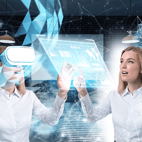
And what exactly is a “digital twin?”
“A digital twin represents a real object in the digital world. It could be a material or immaterial object. Digital twins are comprised of data and algorithms and can be linked to the real world through sensors.” (Big Data Insider, 2018)
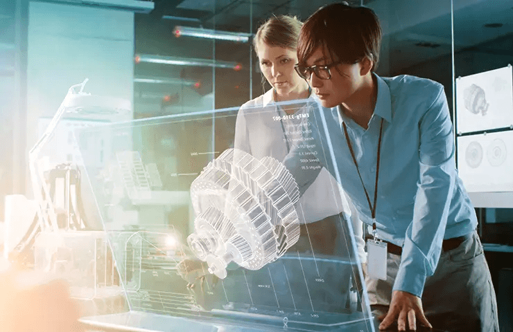
These might be representations of products, services or processes with properties that are stored in digital systems – so far, nothing new, really! But thanks to modern technologies such as virtual reality (VR) and augmented reality (AR), users can now access this data in a “realistic” way, instead of having to dig through endless spreadsheets to find the properties they need. In the case of our digital forest, VR and 3D graphics are used to simulate a walk through the woods. Thus, modern technologies are permanently transforming and streamlining the way the work is done. You can monitor individual trees, review their properties and perform various operations – for instance, schedule an area for clearing. Sounds crazy? Imagine that you can now “read” individual trees and take action accordingly.
What else is happening in digital forestry? Research is also being conducted to develop new technologies to detect damage from bark beetles early on, even before it becomes visible to the human eye. VR glasses are not necessarily required in order to access this kind of information. Rather, it can be pulled up easily on a smartphone or tablet.
It’s not only happening in Finland
According to researchers at the Institute for Man-Machine Interaction at the RWTH Aachen University, this development is only the beginning of a digital revolution in agriculture and forestry. For example, one team at the institute is working on connecting digital forests with GPS-guided harvesters. This would make it possible to target specially selected trees which would not be easy to find at all in the “real” forest. With the use of navigation maps, environmental sensors and laser scanners, the harvester is guided to the precise location of the tree selected by the forest ranger and then fells that exact tree. You’re probably wondering how it works...
5G and satellites as enablers
In order to enable the harvester to perform real-time navigation and identify the selected tree using GPS data accurate to one centimeter, combined with sensor data, we first have to set up the necessary infrastructure. The latest mobile phone generation (5G) allows for low-latency data transmission from the sensors to the control hub and vice versa in near real-time. Meanwhile, the latest satellite and drone imaging technologies provide the database for forest management decisions that would not be visible to the naked eye (for instance, using infrared mapping.) Thus, both economically and ecologically relevant decisions can be made and implemented almost instantly, automatically and without human intervention – the ultimate in forest management.
Conclusion
Despite continued criticism, particularly with regard to 5G, this technology can help make forest management better and more precise. By preventing clear-cutting and enabling early pest detection, it allows for sustainable and needs-based raw material provision. As a result, modern technologies can help us protect the fragile ecosystem we call “forest” and preserve it for generations to come.
Keywords
More similar blogposts:

Found what you were looking for?
Start your intelligent search now